
Plone Google Maps (0.2)
by
maria
—
last modified
2009-01-02
Released on 2008-02-26 by Quintagroup for Plone 2.5 under GPL - GNU General Public License available for All platforms.
Software development stage: stable
- Plone Google Maps download link: http://plone.org/products/plone-google-maps/releases
- Homepage of Plone Google Maps: http://plone.org/products/plone-google-maps
- Plone Google Maps repository: http://projects.quintagroup.com/products/browser/qPloneGoogleMaps
- Description source: http://projects.quintagroup.com/products/browser/qPloneGoogleMaps/trunk/README.txt
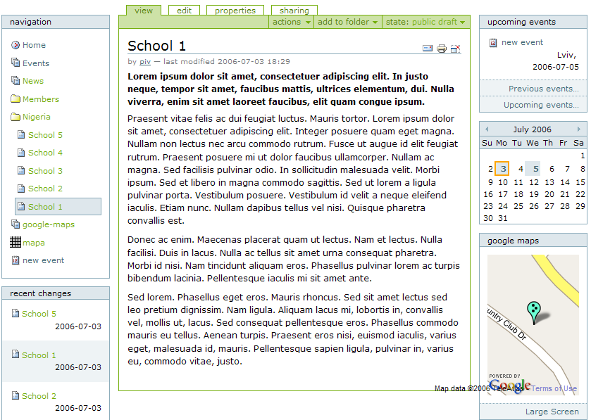
Plone Google Maps (qPloneGoogleMaps) is a Google Maps view product for the Plone content management system which enables integration of Google Maps into Plone sites.
Plone Google Maps Features
- Due to qPloneGoogleMaps you can set up the latitude and longitude of your site objects and have their maps exhibited on your site.
- Any object with the latitude-longitude has an additional map portlet displaying this object. This portlet, in turn, has a template "Large screen". If you click on the large screen below the portlet, you will be able to see the full-size map of the page with its description.
- The folders containing objects with the latitude-longitude parameters have an additional display view - "maps view", which gives an opportunity to see the full-size map with all these objects.
- There is a new content type "Map" which can have other content types - "overlays". It enables the positioning of different objects on one map showing them with the markers of different colours.
Plone Google Maps Installation
- Install qPloneGoogleMaps and geolocation as Zope products
- Install these two products in your Plone instance with Quick Installer (Plone Control Panel ->Add/remove Products)


